slideshow 1 slideshow 2 slideshow 3 slideshow 4 slideshow 5 slideshow 6 slideshow 7

**VIDEO** Gerringong Storm 21/01/16

Bureau storm damage assessment confirms Kurnell tornado

Bureau storm damage assessment confirms Kurnell tornado
17/12/2015

Issued: Thursday 17 December 2015

Early results from a Bureau of Meteorology damage assessment of the severe thunderstorms that impacted parts of Sydney yesterday have confirmed a tornado.
Kurnell and the surrounding coastal region was affected mid-morning yesterday with a peak wind gust of 213km/h recorded at the Kurnell Automatic Weather Station.

Top 5 Storm Chases of the Season So Far 2015

18 Minutes of highlights from Mr Keene's highlights to date and the top 5 of our storm chases so far with Michael Keene, Chris Adams & David Metcalf representing the best of Storm Spotters Australia / Illawarra Storm Chasers.

Kurnell Tornado 16/12/15

Some amazing aftermath video of the Kurnell Tornado 16/12/15. Our thoughts are with those effected by this extraordinary event.

Video - Mick Winney (YouTube)

SE QLD Chase - Going the distance

Our SE QLD storm chase from a different perspective. The dashcam. We hope to share some more footage soon.
Thanks to Michael for putting it together.
Chris.

SE QLD Chase Sample 29/11/15

Mundubbera QLD Storm - 29/12/2015

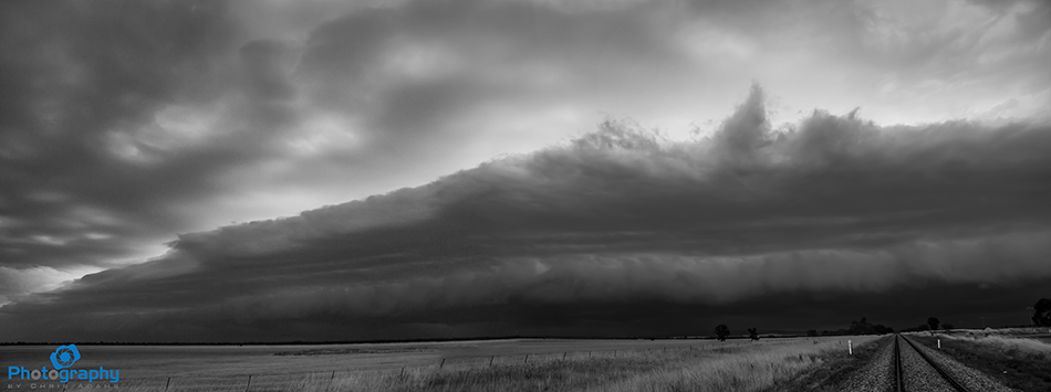
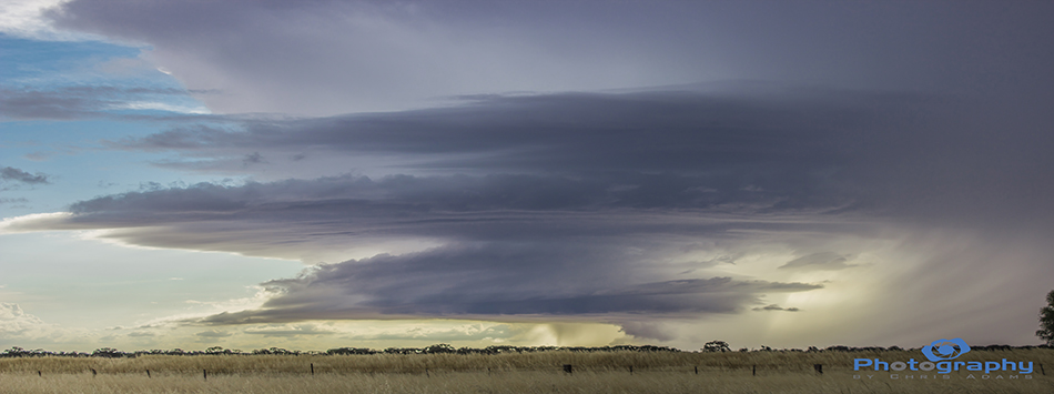
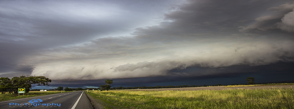
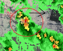
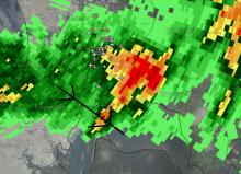
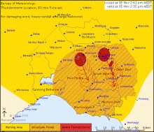
The 29th of November saw us chasing 300 kms north west of Brisbane to the town of Mundubbera.

We were able to get ahead of this massive storm which gave us sustained 80-100km/h winds,with stronger gusts, for over half an hour along with torrential rain. No hail, just a true rain monster.

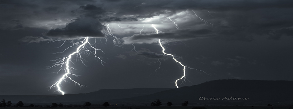
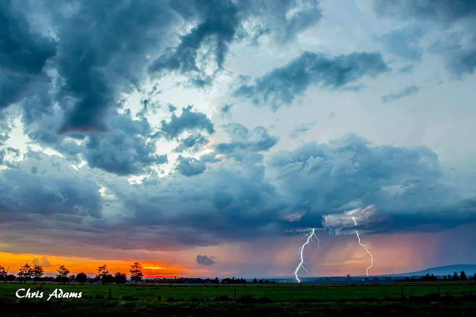
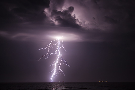
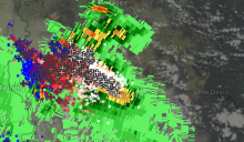
Lightning was insane inside the core with non stop flashing, and numerous close strikes with loud bangs of thunder. It felt like a true tropical storm This 2 minute shows some high lights from the storm. With Chris Adams.

Michael Keene

Climate and Water Outlook, November 2015 — January 2016

Climate and Water Outlook, November 2015 — January 2016 (Bureau of Meteorology)

Severe Storm on Radar near Tumut NSW 6:15PM 05/11/15

SSA Has picked up a Severe Storm on Radar near Tumut NSW. Please take care in the area!
This storm could produce large hail, Damaging Winds. This looks to be a Super Cell storm.

Severe Storm near Mudgee NSW - 5/11/15

**Severe Storm Alert** SSA Admin Michael Keene is currently on the ground intercepting this storm around 40-50km south of Mudgee NSW.
He is reporting 5-6cm hail and winds of around or exceeding 90km/h.
Please use extreme caution!

Large Hal & Strong Winds Alert - NSW

**LARGE HAIL ALERT** NSW
Fellow SSA Admin Michael Keene​ is currently out chasing and he is reporting 5-6cm hail and winds to around 90km/h around 50km South West of Mudgee NSW.

Riverina Chase Highlights - 31/10/15 to 01/11/15.

One of the best super cells in Southern NSW I have ever seen! The Best Gust Front. It was a awesome chase and this is just the highlights!!!!

Severe Thunderstorms Ease in the Melbourne Area

Severe Thunderstorms in the Melbourne Area are starting to weaken and I would imagine the Cancellation of the Warning for Melbourne Area shortly.

Melbourne Tornado Warning Cancelled - Severe Storms Remain.

**VIC MELBOURNE SITUATION UPDATE**
**NO FURTHER REPORTS OF TORNADOES**

TOP PRIORITY FOR IMMEDIATE BROADCAST

SEVERE THUNDERSTORM WARNING - MELBOURNE AREA

for DAMAGING WIND, HEAVY RAINFALL and LARGE HAILSTONES

Tornado Alert - Melbourne Area

PLEASE TAKE CARE - SEVERE WEATHER ALERT
MELBOURNE AREA - TORNADOES REPORTED
This Super Cell system is moving towards Port Philip Bay over the next hour!

TOP PRIORITY FOR IMMEDIATE BROADCAST
SEVERE THUNDERSTORM WARNING - MELBOURNE AREA

for DESTRUCTIVE WIND, HEAVY RAINFALL, LARGE HAILSTONES and TORNADOES

Pages