- NSW Sheep graziers warning issued at 4:42am EST
- SA Sheep graziers warning issued at 4:10am CST
- More national weather
- VIC Sheep graziers warning issued at 4:50am EST
- NSW Coastal wind warning issued at 4:10am EST
- NSW Coastal wind warning issued at 3:48am EST
- NSW Coastal wind warning issued at 3:48am EST
You are here
QLD gets some relief, Flood waters could take time to reduced. Focus shifts to NSW. 9:00pm 19th June 2016.

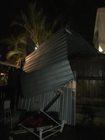
The situation is easing in QLD & SE QLD with the Bureau of Meteorology issuing cancellations to both their warnings in the area and the latest radar shows activity moving in to New South Wales and off the Queensland coast. Water spouts off the Queensland coast are still possible though seeing one at night could be tricky!
Attention now turns to the New South Wales Illawarra & South Coast as that area is expected to be the hardest hit by this fast moving system before some relief Monday morning. This relief will be short lived with strong to gale force winds expected to cause more damage to the region from Monday afternoon.
Keep an eye on http://www.bom.gov.au/australia/warnings/index.shtml for all the latest warnings issued by the Bureau, these can also be found on our Facebook page: facebook.com/stormspottersaustralia
Storm Spotters Australia will continue to monitor the situation with wild weather set to give the coastal fringes a rough night ahead.
Image: Louise Thorne Facebook (Sunny Coast Community) Facebook.