You are here
Roads Update - 8:00pm

ROADS UPDATE - 8:00PM 24/08/15
**Reports of water of roads in the Southern Illawarra, Please take care.**
Grenfell Henry Lawson Way at Mid Western Hwy
FLOODING
Started today 7:49pm
Impact: Impact Traffic affected in both directions.
Attending: Local council
Advice: Exercise caution
Batlow Batlow Rd at 6km North Of Batlow
HAZARD Fallen tree
Started today 7:48pm
Impact: Impact Traffic affected in both directions.
Attending: Local council
Advice: Exercise caution
Mount Kuring-gai Pacific Hwy at Beaumont Rd
BREAKDOWN Truck
Started today 7:46pm
Impact: Impact 1 of 2 southbound lane(s) closed (lane 1).
Attending:RMS
Advice: Exercise caution
Figtree M1 Princes Mwy (F6) at Princes Hwy overpass
ACCIDENT 2 cars
Started today 6:34pm, last checked today 7:40pm
Impact: Impact Southbound lane closed (breakdown lane).
Attending:Emergency service(s)
Advice: Expect delays
Exercise caution
Other Info: A pole that was hit and damaged is currently being replaced.
Ardlethan Newell Hwy at 15 east of Ardlethan
FLOODING
Started today 7:19pm, last checked today 7:39pm
Impact: Impact Traffic affected in both directions.
Port Botany Botany Rd at Mccauley St
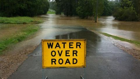
HAZARD Water over the road
Started today 7:27pm, last checked today 7:35pm
Impact: Impact Westbound traffic affected.
Advice: Exercise caution
Other Info:The water is in lane 1 of 3.
Beckom Newell Hwy
FLOODING
Started today 7:14pm, last checked today 7:17pm
Impact: Impact Traffic affected in both directions.
Advice: Exercise caution
Pymble Pacific Hwy near Telegraph Rd
HAZARD Pothole
Started today 6:53pm, last checked today 7:13pm
Impact: Impact Northbound traffic affected.
Attending:RMS
Advice: Exercise caution
Other Info: The pothole is in lane 3.
Maintenance crew is attending.
Ferodale Pacific Hwy near Richardson Rd
HAZARD Animal carcass
Started today 7:06pm
Impact: Impact Southbound traffic affected.
Attending:RMS
Advice: Exercise caution
Other Info:The animal carcass is in lane 2.
Caringbah Taren Point Rd near Paraweena Rd
HAZARD Road subsidence
Started today 6:35pm, last checked today 6:40pm
Impact: Impact 1 of 3 southbound lane(s) closed (lane 1).
Attending:RMS
Advice: Exercise caution
Temo
ra Burley Griffin Way between Temora and Newell Hwy
FLOODING
Started today 3:45pm, last checked today 6:18pm
Impact: Impact Traffic affected in both directions.
Attending:Local council
Advice: Reduce speed
Exercise caution
Blacktown City Council Various roads
FLOODING
Started 23/04/2015 7:49am, last checked today 6:18pm
Website:
Blacktown City Council
Advice: Avoid the area
Use alternative route
Public transport:Route T75 buses are diverting off Rouse Road in Rouse Hill as the causeway is flooded. Services are using Windsor Road and Schofields Road instead, and are missing three stops.
Other Info:Rouse Rd, Rouse Hill is closed due to flooding.
Source: Blacktown City Council (24/8/15 2:10pm)
Bundarra Thunderbolts Way near The Emu Crossing
FLOODING
Started today 4:20pm, last checked today 5:42pm
Impact: Impact Road closed in both directions.
Attending:Local council
Advice: Avoid the area
Exercise caution
Other Info:The closure wil be reassessed on Tuesday.
UNINCORPORATED AREA OF FAR WESTERN REGION (BROKEN HILL) Various roads
FLOODING
Started 15/02/2014 7:37pm, last checked today 4:00pm
Advice: Exercise caution
Check signage
Other Info: The following roads are closed due to flooding:
State Highways
Silver City Highway - Broken Hill to Packsaddle and Tibooburra to Warri Gate - open with caution.
Regional Roads
Mutawintji Road - Silver City Highway to Mutawintji National Park, and from Mutawintji National Park to White Cliffs.
Many local roads are also closed due to flooding.
Please call (08) 8082 6660 for a 24hr recorded road condition report.
CARRATHOOL SHIRE COUNCIL Various Roads
FLOODING
Started 03/04/2014 11:07am, last checked today 10:49am
Advice: Check signage
Exercise caution
Other Info: The following road is closed due to flooding:
Lachlan Valley Way (Hillston to Booligal);
Gunbar Booligal Road;
Mossgiel Road (Hillston to Mossgiel);
Carrathool Road;
Whealbah Road (north of MR80 to Trida);
Pinteebakana Road.
Some roads are open but with caution. Please check signage and exercise caution.
For updates after hours or on weekends or for road emergencies please call 0407 244 429.
Last update 10:45am Monday Wednesday 24 August.
CENTRAL DARLING SHIRE Various roads
FLOODING
Started 18/02/2014 9:31am, last checked today 9:29am
Advice: Check signage
Exercise caution
Other Info: The following roads in the Central Darling Shire are closed by flooding:
Cobb Highway - Wilcannia to Ivanhoe.
Ivanhoe to Balranald;
Ivanhoe to Menindee,
Ivanhoe to Cobar;
Ivanhoe to Trida;
Ivanhoe to Menindee;
Menindee to Pooncarie;
Menindee to Wilcannia (east and west sides);
Wilcannia to Tilpa (east and west sides);
Wilcannia to Wanaaring;
White Cliffs to Mutawintji;
White Cliffs to Mandalay;
White Cliffs to Monolon;
Tilpa to Louth;
Tilpa to Tongo;
Dry Lake Road;
Springdale to Cultowa;
and Cultowa to Trevallyn.
For more information please contact the 24-hour road information line on (08) 8091 5155.
Last council update: 9.28am 24 August.