You are here
Snow/Cold Update - 12/08/15 3:00pm

**WEATHER UPDATE**
At time of writing (2:50pm) Bathurst was under siege by small hall generated by a cold air thunderstorm in the area.
Mean while snow has made a come back to the Central Tablelands for the 5th time this winter.
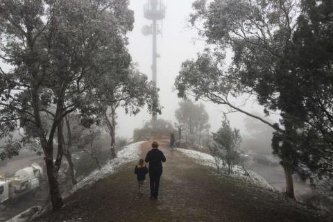
Snow has fallen in Canberra's CBD, Orange, Oberon, Millthorpe and Blayney. Though the snow is falling we will struggle to see accumulation above 1cm in most of these places, Snow chances remain until tonight.
As I mentioned in my first cold weather post, the 3pm to 7pm bracket would see the cool pool of air move over the Southern Highlands and towards the coast, This could also trigger some offshore thunderstorm activity later this evening.
Further more there is a 10% chance of a rumble around the Highlands/Illawarra/Shoalhaven & South Coast.
Winds of around 60km/h could also be expected as the front moves through.
This system won't hang around long and we can see a return of cold morning and sunny days with average temperatures by Thursday afternoon this will allow showers, gusty winds and alpine snow to ease.
Image: Snow on Mount Ainslie (CANBERRA) ABC Jonathon Gul