- QLD Coastal wind warning issued at 10:00pm EST
- TAS Frost warning issued at 4:50pm EST
- SA Frost warning issued at 4:20pm CST
- NSW issued at 4:44pm EST
- NSW Sheep graziers warning issued at 4:42pm EST
- VIC Sheep graziers warning issued at 4:42pm EST
- TAS Coastal wind warning issued at 4:05pm EST
- More national weather
You are here
MORE POSSIBLE SNOW ON THE WAY

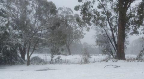
MORE POSSIBLE SNOW ON THE WAY.
Places like Taralga, Crookwell, Orange, Oberon, Armidale, Glen Innes and Guyra could expect at least a dusting of snow to settle by Friday morning with snow expected too fall down to 800m Thursday & in to Friday.
The cold front will bring a pool of cold air behind it this could be some very chilly days for much of NSW.
Western and central NSW could have their coldest days in half a decade on Thursday.
A possible Tasman Low is expected to spin up in the wake of the cold front which will generate showers, winds and cloud along eastern NSW.
This week's cold front is not as strong as the previous one and doesn't hold as much moisture this will limited some of the snow fall potential.
Again this is a potential too see some thunderstorm activity associated with this system particularly on Thursday.