You are here
**COLD SNAP DETAILS**

**COLD SNAP DETAILS**
A powerful cold front will begin to cause showers in the south east of WA on Thursday by Friday a powerful cold front and a pair of troughs one over eastern NSW and the other inland QLD will interact to bring showers and a few thunderstorms across eastern QLD, eastern NSW and VIC.
The strong trough moving in from the bite will generate strong and gusty winds and showers in SA and southern WA.
By Saturday things really start to ramp up with a low developing in the Tasman, the front will cross the south east of Australia and bring rain, scattered thunderstorms and snow to alpine regions across NSW, TAS and VIC.
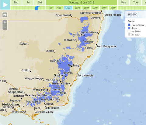
By Sunday & Monday both are going to be bitterly cold with snow forecast to fall down to 600m in some places!
Snow is expected in the Barringtons, Canberra can expect an average maximum of about eight degrees over four days.
Sydney is forecast an average maximum of 15 degrees over four days, widespread showers but only just reach northern SA and southern Queensland and should be heaviest in eastern Victoria and south eastern NSW, where more than 50mm is possible.
Small hail is possible with showers and thunderstorms.
This will all move away quite quickly by Tuesday as a high pressure system wedges itself in place.
Here is the BoM MetEye prediction for Snow fall for Sunday morning at 7 to 10am.